
-
CLIENT
Xiping experimental field -
SCALE
2000 hm² -
CUSTOMER PROFILE
Wheat, Corn Planting Base
Challenges:
The land area is vast, and covering the entire region would require a large number of sensors and IoT devices, resulting in extremely high costs.
Manual inspections require a large workload
Manual inspections cover a large area, making it easy to overlook details.
The boundaries of the area are unclear
At different times and in different regions, the rates of water evaporation/absorption vary, making it difficult to define the boundaries.
Difficulty in Precision Area Management
Different areas require varying amounts of irrigation and pesticide application, making precise control challenging.
Solution:
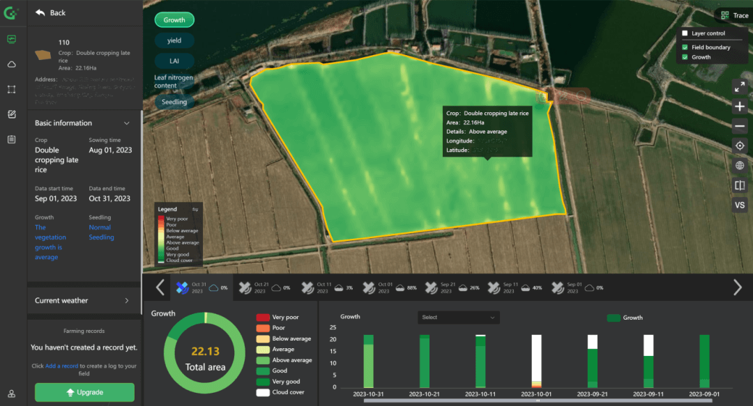
Using satellite remote sensing images, accurately identify water content across different times and regions. Define and establish distinct boundary-based management zones.

AI manages different zones, installing a limited number of sensors in specific areas to achieve regional monitoring.

AI generates irrigation plans based on the water requirements of crops in different zones.

Implement supervision by zones, using drones and AI recognition for spot checks. This enables daily data collection and statistics.


